Past event — This event ended 14 days ago.
Buena Vista Park & Sutro Mountain Hike (Haight Street Fair) Dogs welcome
About the event
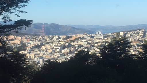
This San Francisco Urban Hike starts in the Duboce neighborhood and Park and will move up to Buena Vista Park with views of the bay the ocean and the bridge then we’ll go through Haight Street (Haight street fair) in the and the Haight-Ashbury district, with bazaar hippie stores, collection of retro clothes stores. The Haight is one of the few neighborhoods that was not hit hard by the 1906 earthquake. As a result, it has the highest concentration of still-intact Victorian homes in the city. We then make a way up to Sutro Mountain Home of Sutro Tower. We head to tank hill which is just north of twin peaks and then visit Mount Olympus statue, climb the steps to the top of Corona Heights Park and make our way back through Buena Vista Park and the starting point.
Trailhead / Meeting Point: Duboce park near the Harvey Milk Recreational Arts Center, Duboce Avenue and Scott Street, 50 Scott Street, San Francisco, CA 94143
Level: Intermediate Total Distance: 8.3 miles Hiking Time: 3.5 - 4.5 hours Elevation: 575 feet Buena Vista Park Hill and 909 feet Mt Sutro, 320 Corona Heights Park Information: Restroom near staging area (Duboce Cafe), Free Parking around Duboce Neighborhood. Dogs are Welcome on Leash
GPS Coordinates for Trailhead: Duboce park near the Harvey Milk Recreational Arts Center, Duboce Avenue and Scott Street, 50 Scott Street, San Francisco, CA 94143
Latitude: 37°76'95.11"N Longitude: -122°43'44.88"W
Map: (SFMTA – includes all City Transit information) https://www.sfmta.com/sites/default/files/pressreleases/2015/Muni%20Map%202015.pdf
Hiking Directions: Starting Point; Duboce park in front of the Harvey Milk Recreational Arts Center, head uphill on Duboce Avenue, up the stairs continue on the path uphill visit the left past the tennis courts up the hill continue left uphill reaching Buena Vista Heights (Group photo), then downhill continue right stay right on the trails continue right past the dog run continue straight to take the steps down and tell Heath Street left on eighth Street all the way up and into the Golden Gate park, left around keys are stadium and continue on Willard Street, left on Belmont Avenue right on Edgewood Avenue, at the end take Edgewood Trail up hill, last pass the wooden carvings, right up fairy gate Trail continue until you reach mount Sutro summit (Break), downhill on East Ridge Trail, right on Johnston Drive left on Medical Center, downhill on East Wood Trail, right on fairy gates trail continue right exit mount Central Park continue on Belgrave Avenue, upstairs on tank he’ll reach the summit then back down the stairs and right on the trail left on Twin Peaks Boulevard crossover 17th St. and right on 17th St. upstairs left up upper terrace upstairs to mount Olympus, Down Art Alley staircase left on upper Terrace, Right Roosevelt Way Up Stairway to Corona Park Right Path to the top, then downstairs Left Roosevelt Way, Right upper Terrace, and to Buena Vista Park continue middle fork Trail, exit Right downhill on stairs to DuBose Avenue, continue straight until reaching Deboce park and the starting point.
Directions: From 101 north or south take I80 West Golden Gate bridge, exit 434A North central freeway onto Duboce Avenue, slight right on the Buchanan Street, turn left onto Waller Street, turn left onto Scott Street, Duboce park near the Harvey Milk Recreational Arts Center, Duboce Avenue and Scott Street, 50 Scott Street, San Francisco, CA 94143
Carpooling Link: (Sign up here) https://www.groupcarpool.com/t/y4vwis
Carpooling Procedures: No carpool discussion in the comments, join the carpool link and contact the driver or rider directly. Thank you.......
Legal Disclaimer: Under what we are about Section [https://www.meetup.com/Urban-and-Bay-Hikers/](https://www.meetup.com/Urban-and-Bay-Hikers/)