Lambak Butterfly Trail Challenge: Day Hike
About the event
*Ready for sign-up!* Up for this challenge? Question? [WhatsApp organizer](http://wa.link/j2at9z) ➡️ Pay to secure a slot Min. 8 pax to confirm.
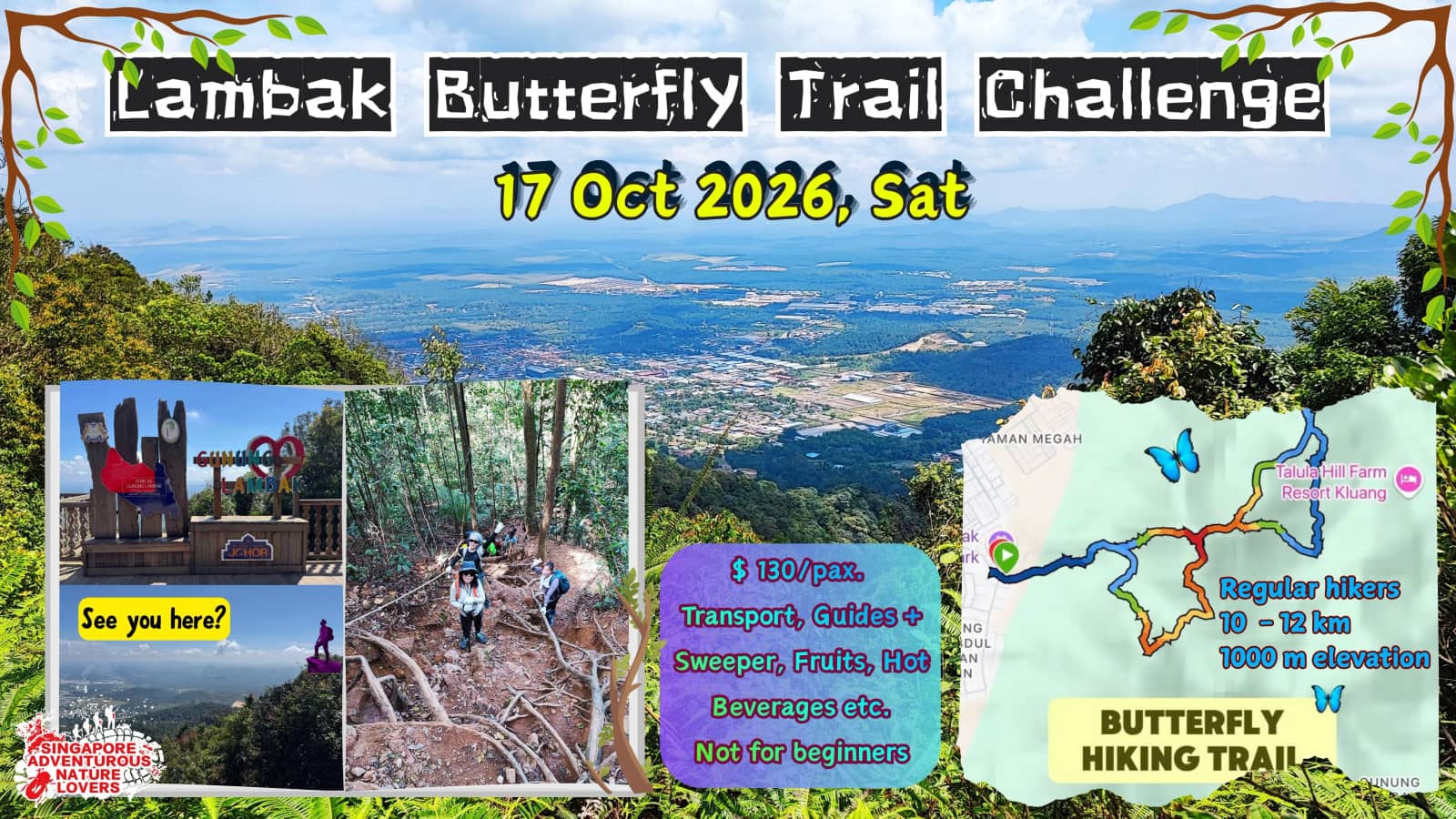
[Gunung Lambak](https://www.google.com/viewer/place?mid=/m/0g3qrk&sa=X&ved=2ahUKEwiZpYj0jtmSAxWP3jgGHcArL6UQqdYPegQIAhAC) (Mount Lambak) is a popular hiking destination located in the Kluang District of Johor, Malaysia, standing at an elevation of 510 metres. It is widely regarded as a beginner-friendly mountain, though it features varied terrain that can still provide a good workout for experienced hikers. This butterfly loop is a challenging route for very good training
Hiking Overview The mountain offers several trails ranging from paved roads to steep jungle paths.
The Gunung Lambak Butterfly Route in Johor, that connects the two summits of Gunung Lambak (510m) in a shape resembling a butterfly. This intermediate-to-advanced trail is renowned for its steep, technical terrain, narrow ridges, and dense forest, making it a popular training ground for larger hikes.
Key Features of the Butterfly Route
• Total Distance: Approximately 10 – 12 km (variations exist, with some shortcut routes recorded at 10 km). • Elevation Gain: Roughly \~ 900+ meters, with steep, non-stop climbs. 👉 *A few sections with ropes and tree roots only! Gloves will be good.* 👈 • Duration: Typically takes 5–6 hours, depending on pace and trail conditions. 👉 *We will start earlier and allow more time for a slower pace. Safety is of utmost importance*. 👈 • Highlights: Covers both the North and South peaks, passing through steep, rooted terrain, ridge walks, and dense, scenic jungle.
Route Details
• The "Butterfly" Concept: The route lets you summit both the North and South peaks in one go. You typically go up one summit, descend, and then climb back up the other to complete the "wings" of the butterfly. • Terrain: Expect dense forest, sprawling tree roots, and muddy trails. Some sections have a 60-degree incline requiring the use of fixed ropes. The trail is mostly steep jungle terrain with high steps, exposed roots, and no flat ground.
Who is Suitable? Regular hikers who have hiked in Malaysia's terrain before will appreciate the beginner-friendly options: Panti, Pulai, Broga, Arong, Blue Lake, Bukit Mor, or the intermediate options like Datok and Angsi. This will be a higher level of your skills. Not suitable if you have never hiked in Malaysian jungle terrain before. Parks & Gardens are not counted.
Local breakfast and pack your own lunch - We will find a good local kopitam in Kluang town. This explains why we depart early from Marsiling. It is \~ 100 km\, a 100-minute drive from CIQ to Kluang town.
We will go for dinner either at an open-air night food street or a Sunday night market, before driving home.
Cost: SGD 130/pax Min 8 pax to confirm. Max 28
Inclusive:
• 2-way Air-Con VIP Coach, *Minivan if less than 12 pax* • Private vehicle Pickup from & Return to Marsiling station • Certified & licensed mountain guides • Fruits, Kopi & Tea [during lunch on the summit] • Entrance Fees • First aid kit by the guide • Radio communication equipment • Our Management & Operational costs
Exclusive:
• Travel Insurance (highly recommended) • All personal expenses, eg, Meals • All others not mentioned above
𝐁𝐫𝐢𝐞𝐟 𝐢𝐭𝐢𝐧𝐞𝐫𝐚𝐫𝐲
• 5.30 am Pickup from Marsiling Station bus stop • Cross JB Custom • Enjoy a hearty & yummy breakfast @ local traditional kopitam & pack lunch [BYO] • Meet at the trailhead & start Hike • Lunch at the top with fruit and boiled kopi/tea provided • End hike • Wash up / shower • Drive to Johor for dinner [if time permits] • Reach Marsiling \~ 9.30 pm
📌 Important: Ensure you have valid travel insurance Briefing notes & Packing list will be given. 👈
Disclaimer: Singapore Adventurous Nature-Lovers Meetup is an amateur adventure platform that welcomes all outdoor adventure seekers. By joining the activities, all participants are deemed to have agreed to the terms and conditions contained in…